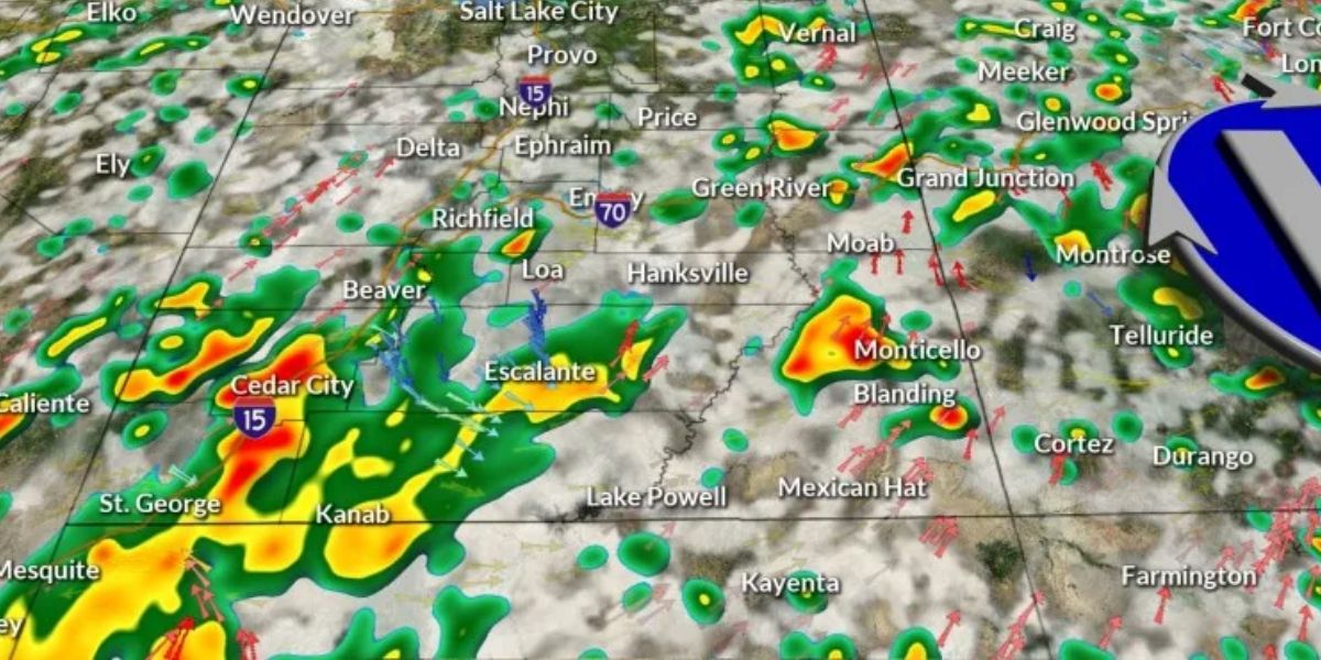
SALT LAKE CITY — Utah, have a great Thursday! In northern Utah on Thursday afternoon, the skies will be partly cloudy and the air will be hazy. It appears like monsoon moisture will build up over southern Utah on Thursday afternoon, which might mean significant rain in some areas.
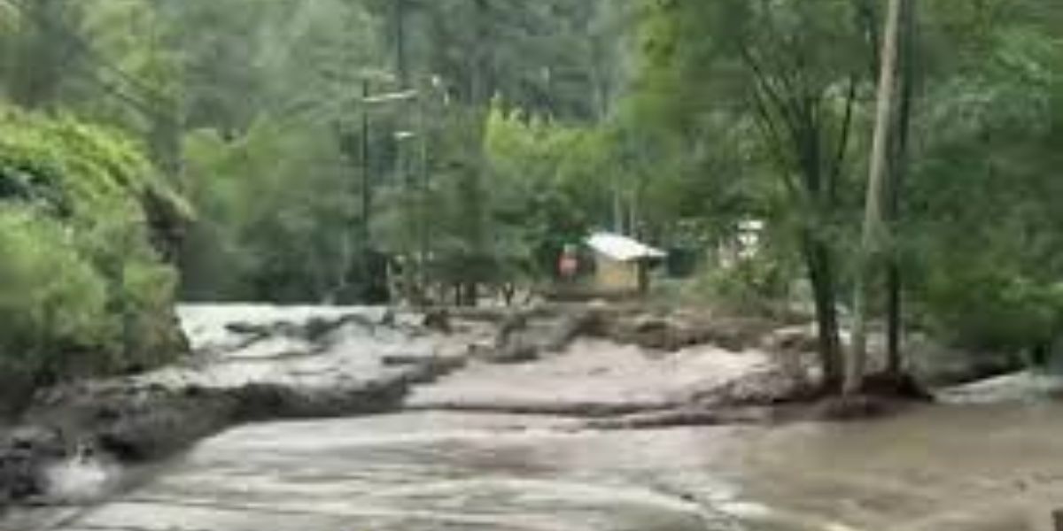
A Flood Watch is in force for some sections of SW Utah until midnight Friday. This is because there is a chance of heavy rain in this part of the state late this evening and into tonight. Heavy rain could cause the water levels in some of our normally dry washes, slot canyons, and low-lying urban areas to rise quickly. Have a means to get weather alerts all night long.
On Friday, a boundary will start to move south across Utah. This system could assist draw more precipitation north across northern and central Utah, which might mean more rain for the northern half of the state on Friday afternoon. There is a small chance of flash flooding spreading along the I-80 corridor in the afternoon when heavy rain falls closer to the front.
We will keep a risk of a few isolated storms in the forecast for the start of the weekend. After that, the air will get drier again by the end of the weekend and into next week. The Wasatch Front will stay in the mid- to upper-90s, while SW Utah will see highs go back up to the triple digits.
A high pressure ridge to our east will keep things quite stable across the region, so it looks like it will stay mostly dry and warm for much of next week.