CEDAR RAPIDS, Iowa – Road conditions may deteriorate overnight where snow falls, but should improve during Tuesday.
Your First Alert: Southern storm track limits impacts
Rain, mixing with or changing to snow in some places, continues to fall in eastern Iowa overnight.
Temperatures tonight slip into the upper 20s to low 30s in most spots. Winds will increase throughout the night, with speeds in the 10 to 20 mph range by daytime on Tuesday.
While temperatures remain near or just below freezing by daybreak, it will be difficult to see significant snow accumulations in most spots. But, we could get between a trace to an inch in many locations, with the best chance of the higher end of that range in our central and southern zones.
Use caution when heading out on Tuesday morning, especially where snow is falling. It doesn’t take a lot of frozen precipitation to cause some slick areas. As the sun comes up, we should keep those marginal temperatures and add solar energy to result in mostly better road conditions.
Blustery, colder around New Year’s
As this storm system exits, winds will remain a pretty big factor on your New Year’s Eve. Speeds between 20 to 30 mph will be common, potentially with a few higher gusts. This will make temperatures in the low 30s during the day feel chillier than that.
A few flurries or isolated snow showers could still be found during the day into the evening, though they would generally be on the light side. This shouldn’t be too much of a problem for those celebrating the holiday on New Year’s Eve.
New Year’s Day is also looking quiet around here, but somewhat windy and chilly. Highs only head for the 20s, with much of the day spent with wind chill values in the 10s. A bit of sunshine could appear, though, which would help to offset that a bit.
Your First Alert: Another shot at light snow Thursday
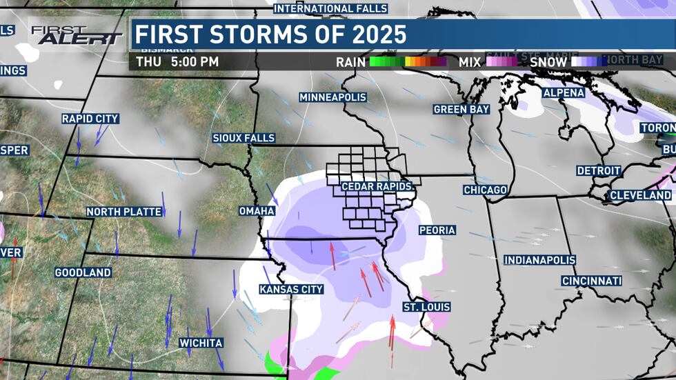
Another storm system will move into the region by late Wednesday night into Thursday, giving parts of the area a dose of wintry weather.
Right now, the track of this disturbance would again favor our central and southern zones for the best opportunity to see snow that sticks. With colder air in place, this snow would be of the lighter, fluffier variety than what’s expected tonight. Our northern zones, on the other hand, could miss out on most of it.

This would again lead to some slick roadways where the snow falls, as it falls. If you have travel plans on Thursday, be ready to make some adjustments in terms of timing if your route heads through southern Iowa, northern Missouri, or central Illinois.
Colder and quiet toward the weekend’s start
Temperatures behind this storm system take another hit, with highs only in the mid 10s to low 20s by Friday throughout the weekend. Overnight lows will be in the single digits to low 10s.
This time frame looks pretty quiet, though, as an area of high pressure mostly controls our weather. This creates the potential for some clearing on a somewhat blustery Friday. Saturday will have lighter winds as the high pressure center moves on.
Your First Alert: Watching another storm late weekend into next week
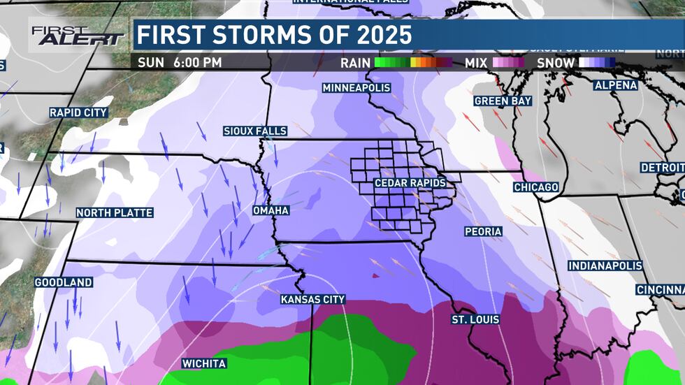
As it does, it makes way for another storm system to develop and move through the region. This one could, if things come together right, provide a decent shot at snow.
The opportunity comes as soon as later Saturday night, when moisture ahead of this system will move into Iowa. Much like today, we may need to overcome some drier air, likely leading to lower-end impacts by Sunday morning, if any.
A wider area of snow could impact eastern Iowa during the day on Sunday into Sunday night, with precipitation wrapping up on Monday. It’s during this time where snow could accumulate and cause travel hazards.

We want you to stay with us in the coming days as we get closer to Sunday into Monday, and we’ll bring you the latest as we know it.
Coldest air of the season so far
No matter the outcome in terms of total snowfall potential between now and next week, there are strong indications that we’re headed into a very cold winter pattern. Temperatures will be 15 to 25 degrees below normal, with wind chill concerns developing at times.


Leave a Reply